I left on Thursday evening - May 31st
I traveled on I-80, 90 & 94 to North Dakota and slept at rest stops.
I-80 in Pennsylvania was very fast. Governor Corzine must have been in all of the cars as many were hitting 90 mph.
I rested just north of State College and then again on the Ohio Turnpike. My next rest stops were in Wisconsin and Minnesota.
Chicago was horrible as traffic on all freeways was very slow - the slowest I have ever experienced. The people on the radio acted as if it was normal and no big deal.
Illinois (north of Chicago) had the best rest areas (for food). Pennsylvania was the best for sleeping.
In Wisconsin I encountered a major storm. It rained so hard that the freeway practically came to a stop. 4 wheel drive is a great thing.
I arrived in North Dakota early on Saturday and toured Fargo. I ate at Taco Johns which had some very hot green sauce. The food was better than Taco Bell and better than the Taco Johns which I ate at in Texas last year.
Grand Forks is the home of The University of North Dakota. Fargo is the home of North Dakota State. North Dakota was nicer than ND State, but the football stands are only on one side of the field. Grand Forks is a nice town.
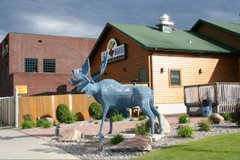
I ate across the river in Minnesota (no toll required to cross the river from state to state) at a place called the Blue Moose. I have a post about it below.
Sunday - June 3rd:
I drove from Grand Forks to Minot to Bismarck.
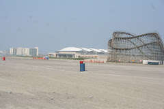
Drove by Crystal Lake - the largest lake in North Dakota. Very little development around the lake. The main attraction is the Spirit River Casino. Of course it is nothing compared to an Atlantic City casino, but they do have a few tables for card games.
I then drove to Minot and ate at Burger Time - not bad, but nothing special.
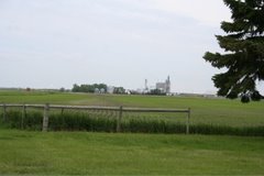
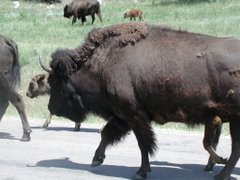
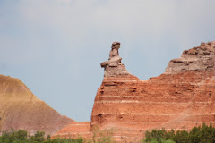
Next I headed south to Bismarck. On the way there is the Lewis and Clark exhibit (which is not free so I didn't bother going in). I also saw the greatest bull that I have ever seen. The cows in this state are as nice as those in Virginia (much better than Texas).
Beginning at Minot, the terrain gets less flat.
I just ate at Famous Dave's. I had a platter that had ribs, brisket and pork b-b-q. I am stuffed. I had to bring some back to the motel for later. Talked to a very nice server. She is interested in coming east to study music. I told her to check out Westminster Choir. Of course, I told her to also check out Wildwood.
Monday June 4th:
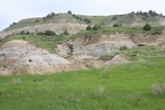
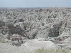
Drove through Teddy Roosevelt National Park on the way to Montana. This is a stop worth seeing! I will be posting more photos of the park on the sidebar at a later date as this internet connection is poor in this motel.
Teddy Roosevelt is my favorite. He was the first ti propose many social reforms which later enacted by his cousin and LBJ + he was the first to establish National Parks and other preservaion measures. he was th first to have a person of African desent dine in the White House. BUT, he was tough militarily. He was the best of the liberal and conservative points of views. He knew where to draw the line on both points of view. He didn't just talk either. If he said it, he meant it.
Met a guy from Medford in Medora (at the park entrance) who is a DJ in Vineland - Medford Steve on 97.1. He plays doo wop music. He is related to one of Teddy Roosevelt's Rough Riders.
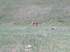
I am now in Billings, Montana. I drove along I-94 which follows the route of the Yellowstone River. Great looking cattle here also - saw a farm of "RED" Angus.
Ate at Taco John's - not as good as the one in Fargo.
Tuesday June 5th:
Visited Little Big Horn: Well, every movie that I have seen about Custer's Last Stand seems to have been inaccurate. The People of the Prairie were not waiting to ambush Custer. They were responding to being attacked. Also, Custer's strategy was horrible. He grossly underestimated the number of natives in the camp and split his troops in too many directions creating small vulnerable units. Only one movie than I have seen even showed the proper terrain. Custer got what was coming to him. His philosophy of making war on the total population (as demonstrated during the War Between the States) would be considered terrorism today. He was even known to take women and children hostage and to use them as shields to force the enemy to lay down their arms.
Ate at the Cactus Creek Steak Outfitters. Not bad. Evidently it is a chain that is owned by Chuckee Cheese.
Wednesday June 6th:
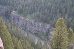
Traveled to Yellowstone and explored the northern section.
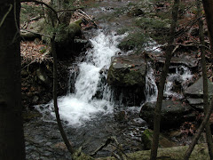
Mammoth Springs was the top attraction. I also visited 2 waterfalls and took some photos of an interesting canyon.
It snowed at the top of Mt. Washburn.
Thursday June 7th:
Visited Old Faithful and other sights.
I will post photos as I am able.
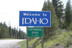
Traveled into Idaho - photos of Idaho will be posted on sidebar.
I am in West Yellowstone, Montana - close to Idaho and Wyoming.
Friday, June 8th:
I spent the day touring the geyser area and spent a few hours at Old Faithful. Old Faithful was better than the day before - the eruptions are different each time.
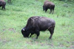
Ate a buffalo burger. They also had elk burgers.
Saturday, June 9th
Traveled through Yellowstone to the Grand Tetons and then to Jackson, Wyoming.
The Grand Tetons are spectacular to view, but only the serious hiker should attempt to climb them.
I saw a Jersey tag for the first time since I left the Delaware Valley.
Jackson Hole refers to the area and Jackson is the town. Jackson Hole is a valley area between mountains.
I ate at Gun Barrel Steak and Game House and had a buffalo steak, which was very good. they recommend that you order rare or medium rare. I ordered medium rare and it was the correct choice. The green beans had a mesquite taste and were excellent. The only disappointment was that they didn't have any unique soups. they had Manhatten Clam Chowder and French Onion. The server was from the Scranton area and was familiar with South Jersey. She likes where we live and even knew of my BORO.
Sunday, June 10th:
Drove from Jackson to Casper, Wy.
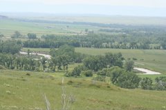
After I left the Tetons, there were many hills similiar in nature until I reahed a region that reminded me of the Theodore roosevelt National Park area - a mixture of prairie and badlands type hills. As I drove east, the prairie expanded. This is the Great Plains!
I have photos from the Snake River area of Grand Teton National Park and also of the view from the road to Casper.
I ate again at a Taco John's and they had a burrito specific to this area (Casper). Later I ate at a Mexican restaurant which had a good totilla soup. Their menu did not have exactly what I wanted, but I told them what I wanted and they made it. They were better than the Mexican places in Arkansas and Texas that I tried last year, but the best, in my opinion are in THE BORO and Hammonton. Maybe I just haven't found the ones out west where the Mexicans eat.
Monday, June 11th:
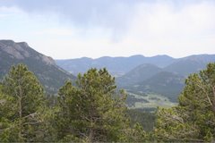
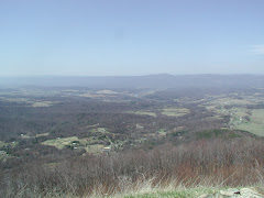
I traveled south from Casper to Colorado and then west to Rocky Mountain National Park. I am now in the Denver area.
Rocky Mountain National Park is very high up. At one point the road was close to 12,000 ft above sea level. The ranger said there there only about 15 bears in the park due to the high elevation. The drive is not for anyone afraid of heights.
When I left the park I traveled on US 40, I-70 and I-76 which are familiar roads back home.
Tuesday, June 12th:
I traveled from Denver to Dodge City, Kansas.
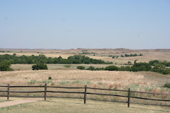
East of Denver, the terrain flattens out. There are a few hills, but it is definitely the western edge of the Great Plains.
Western Kansas is mostly flat, but there are a few hills (South Jersey size hills).
The Dodge City exhibits are easily affordable, but are a joke. Nothing is real. Even Boot Hill is not the real Boot Hill. Too much is myth.
Ate at Taco Tico - not a big selection, but big servings - I got stuffed.
Wednesday, June 13th:
Traveled from Dodge City to Wichita, Kansas. On the way, I traveled through Greensburg, the town that was wiped out by a tornado recently.
I traveled throughout Wichita - nothing special -lots of traffic.
Ate at "Old Chicago" - a pizza and pasta chain. I got stuffed again.
Weatherman on TV mentioned briefly that there had been a couple of tornados. He never said where and acted as if it was not important. It was like mentioning that the high tide happened twice today. Now imagine our weatherpeople if a tornado occured or even a threat of one.
There are a lot of cattle feeding corrals in Kansas. they take the cattle to them for last minute "pumping up". Who knows what they they are feeding them?! I decline to eat a steak in Kansas. The best cattle that I have seen have been in Virginia, North Dakota and Montana - no "pumping up" needed!
Thursday, June 14th:
I am now in Booneville, Missouri which is about halfway between Kansas City and St. Louis.
In Kansas City, I tried 2 "famous" rib joints. The first on was Cage's. it was diasapppointing as the meat was tough and the sauce too much like Kraft. The second one was Arthur Bryant's. The meat was tender and the sauce was special. I still give Dreamland (Tuscaloosa) the edge, but this was a good competitor and worth a side trip if you are in the area.
As you get near Kansas City and then into Missouri, the terrain gets less flat and there are hills.
I did not take a lot of photos. Tomorrow I will have more to photograph, but this is my last motel, so further postings will probably not occur until I get home (probably on Sunday) unless I get lucky and find a rest area with internet (and I have encountered several of those on this trip).
Friday, June 15th:
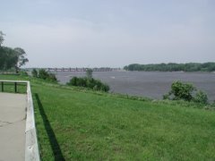
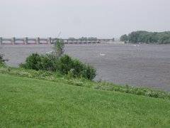
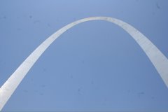
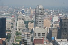
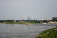
I stopped at Gateway Arch in St. Louis and then proceeded to confluence of Mississippi and Ohio, then traveled through Kentucky, WV, MD and Delaware to home.
Traffic moved smoothly through St. Louis considering rush hour.
The Gateway Arch has a tram to take you to the top. It cost me $10.00. The tram has 8 cars and they assign you a specific car. each car carries 8 people and you better not be large. The entrance to the tram car is only 4 feet high so you have to duck and the seats are close together and not roomy. It was also very hot inside.
When you get to the top, the windows are small and you have to lean over a little to take photos. When you leave, you get assigned to a different car and some families were split up.
Missouri had a lot of rolloing hills and that is the way it was in western Kentucky. Eastern Kentucky had higher hills and mountains as you get closer to West Virginia. West Virginia is the mountainous place you can go. The freewat just winds around mountain after mountain going round and round and up and down. There were no wide valleys like you find in the west.
Western Maryland is also mountainous west of Frederick. As you approach hagerstown and Frederick you are in the Blue Ridge region and the mountains are long ridges.
Traffic from Maryland to home was heavy but fast. In Maryland I finally saw the first Jersey tags since Jackson, Wyoming.
Sunday, June 17, 2007


Thursday, June 14, 2007

Wednesday, June 13, 2007


Tuesday, June 12, 2007


Monday, June 11, 2007
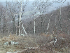
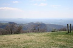
Rocky Mountain National Park

Rocky Mountain National Park is located nortwest of denver in Colorado.
It is very high elevated and not for those who have a fea of heights as the road is on the edge of cliffs in many areas and there is no guard rail. The road goes higher than 2 miles above sea level.
There is much snow on the ground. Some of it is glacial.


Sunday, June 10, 2007
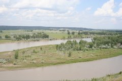
Grand Teton National Park: Rise of the Range

Nine million years ago, the earth's crust broke into two retangular blocks along the Teton Fault, a 40 mile zone of weakness. Through sporadic movements the western block hinged skyward to form the Teton Range, while the estern block tilted downward to form the valley called Jackson Hole. The valley sank four times more than the mountains rose.Displacement continues and an an earthquake producing movement along the fault can occur at any time.
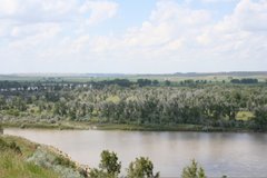
GTNP: Shaping the Mountains

Erosional forces continually shape the rising mountains. Wind, water, ice, and glaciers particularly in the last ice age, shaped the range into today's skyline. The sedimentary rock layers that covered the central peaks have been worn away, but mountain building continues, counteracting erosion.


Subscribe to:
Posts (Atom)